Showing posts with label highways. Show all posts
Sunday, July 17, 2016
Monday, March 16, 2015
NH3 Thal Ghat
This is the Thal Ghat (also known as Kasara Ghat) section of NH3, near the town of Kasara, and before Igatpuri. This was shot during the monsoons, and the lush greenery and mist made for a memorable drive.
© 2014, Abhinav Agarwal (अà¤िनव अग्रवाल). All rights reserved.
Friday, December 5, 2014
NH3 Before Igatpuri
This is a fairly recognizable section of the National Highway 3, as it makes its way towards the picturesque town of Igatpuri, and beyond that to Nashik. It is at this point that the highway bifurcates, and the eastward highway snakes to the left while the westward highway is what you can see in the photo below.
https://www.google.com/maps/@19.6796264,73.5209861,13z
© 2014, Abhinav Agarwal (अà¤िनव अग्रवाल). All rights reserved.
Saturday, September 1, 2012
Dwarkadhish Temple, Rukmini Temple, Dwarka, Gujarat
| Autorickshaw, parked at the edge of Aji Dam, outside Rajkot, Gujarat |
There are two ways to get to Dwarka, and while all routes do lead to God, on the more physical plane, you can either approach it from the coastline that runs along the southern border of Gujarat. This would mean driving past Diu, Somnath, Porbandar, and on to Dwarka. NH 51 runs along this coast and is mostly in bad shape, and driving is slow.
The other option is to take the Ahmedabad-Rajkot state highway, proceed on to Dhrol, and then via Jamnagar, Khambaliya, and on to Dwarka. This is a beautiful highway, and the four-laning work there is nearing completion. This particular stretch below is from the state highway SH25, a short distance from Rajkot, on the way to Jamnagar.
Sunday, January 29, 2012
The Westin Gurgaon, New Delhi
Photographs from The Westin Hotel in Gurgaon. This is a relatively new hotel, and came up only in 2011 (or late 2010), and is strategically located just off the Delhi Gurgaon Expressway, at the Mehrauli Gurgaon Marg, popularly known as MG Road, and the site of literally dozens of malls. What used to be a sleepy road connecting Gurgaon to Mehrauli till as recently as 15 years ago is now a picture-perfect example of chaotic unplanned urbanization.
A most peculiar design decision that baffles, nay boggles, the mind is the decision to have this huge glass partition separating the bedroom from the bathroom, instead of the usual solid wall or partition. This may well appeal to the honeymoon couple out on a romantic rendezvous away from home, or to the flirtatious executive looking to bring, err... work, back to the hotel. But to the family looking for a comfortable room this poses challenges to say the least.
I shot this photo below from my hotel room at 7AM. Within the next half an hour or so this road would become completely clogged with cars trying to get on to the expressway, get off the expressway, and in general create a chaos.
And this photo below was taken at 7PM. Good luck if you work in this area and need to travel back home, or to the airport for that matter. It is therefore not surprising that prices of residential properties near this place are astronomical. I mean obscenely astronomical. More than a crore rupees of apartments is the norm. And some run as high as 5 crores - that is one million US dollars. For a 2000 sq ft apartment.
View Larger Map
© 2012, Abhinav Agarwal. All rights reserved.
A most peculiar design decision that baffles, nay boggles, the mind is the decision to have this huge glass partition separating the bedroom from the bathroom, instead of the usual solid wall or partition. This may well appeal to the honeymoon couple out on a romantic rendezvous away from home, or to the flirtatious executive looking to bring, err... work, back to the hotel. But to the family looking for a comfortable room this poses challenges to say the least.
I shot this photo below from my hotel room at 7AM. Within the next half an hour or so this road would become completely clogged with cars trying to get on to the expressway, get off the expressway, and in general create a chaos.
And this photo below was taken at 7PM. Good luck if you work in this area and need to travel back home, or to the airport for that matter. It is therefore not surprising that prices of residential properties near this place are astronomical. I mean obscenely astronomical. More than a crore rupees of apartments is the norm. And some run as high as 5 crores - that is one million US dollars. For a 2000 sq ft apartment.
View Larger Map
© 2012, Abhinav Agarwal. All rights reserved.
Sunday, August 21, 2011
Scenes from SH25, Tamil Nadu
If you need to drive from Bangalore to Trichy or Tanjore, you can take NH7 all the way down to Namakkal. From there you have two choices. You can either take SH25, down to Thottiyam, Musiri, and on to Trichy. You drive parallel to the Cauvery river, north of the river, and then cross over to enter Trichy. The second option is to continue to drive down to Karur, and then take NH67, that runs south of the Cauvery river. This highway is being four-laned, and once complete, will be a joy to drive on. The four-laning has been completed on the stretch between Trichy and Tanjore, but the process is not yet complete from Trichy to Karur.

So how is the state highway SH25? It is a mixed bag to be sure. From Namakkal to Thottiyam the road is good, with a few bad patches in-between. There is not much traffic, and you can do good time. From Thottiyam onwards the road starts to deteriorate, and near Musiri it is actually quite bad. There are no deep potholes as such, and this is a good thing, but the road has cracks all over. This is the result of the hundreds of trucks that ply on this road. All of them seem to be ferrying earth mined from the Cauvery river. As you drive on this stretch you come across tens of trucks lined behind each other, on both sides of the road. This makes overtaking pretty much impossible, and since this is a two-laned road, any vehicle parked along the side of the road can cause traffic to slow down to a crawl.
Since the highway runs parallel to the Cauvery river, you can see vast stretches of farmland with sugarcane and paddy plantations. The river bed evidently makes for supremely fertile soil, and during the monsoon months you can see a lot of activity in the fields.
View Larger Map
© 2011, Abhinav Agarwal. All rights reserved.
So how is the state highway SH25? It is a mixed bag to be sure. From Namakkal to Thottiyam the road is good, with a few bad patches in-between. There is not much traffic, and you can do good time. From Thottiyam onwards the road starts to deteriorate, and near Musiri it is actually quite bad. There are no deep potholes as such, and this is a good thing, but the road has cracks all over. This is the result of the hundreds of trucks that ply on this road. All of them seem to be ferrying earth mined from the Cauvery river. As you drive on this stretch you come across tens of trucks lined behind each other, on both sides of the road. This makes overtaking pretty much impossible, and since this is a two-laned road, any vehicle parked along the side of the road can cause traffic to slow down to a crawl.
Since the highway runs parallel to the Cauvery river, you can see vast stretches of farmland with sugarcane and paddy plantations. The river bed evidently makes for supremely fertile soil, and during the monsoon months you can see a lot of activity in the fields.
View Larger Map
© 2011, Abhinav Agarwal. All rights reserved.
Monday, August 15, 2011
Idiots on Roads - 8
Look at this photo. This is a four-lane national highway. Beautiful road. Recently four-laned. Allows you to zip between the two towns of Tricy and Thanjavur in less than an hour.
Not much traffic on it. Breaks in the median to allow for traffic to cross over at short distances.
There is really no freaking reason for someone to drive on the freaking wrong side of the road. Not with his wife. And certainly not with a small baby riding pillion. And not in the freaking fast lane. Look at the truck on the OTHER side of the road, which is driving on the CORRECT side of the road. So why is this freaking idiot endangering his life, his wife's, his child's, and that of other people actually following the rules of the road?
The inescapable reason, I deduce Watson, is because he is an idiot.
This is a zoomed out shot of the photo above. Sigh. Sigh. Sigh.
View Larger Map
© 2011, Abhinav Agarwal. All rights reserved.
Monday, June 20, 2011
NH 212 through Bandipur National Park
If you want to go to the Kerala district of Wayanad (see all posts on Wayanad), set on the Western Ghats, one way is to do so via Gundalpet. This is of course assuming that you are driving from Bangalore or Mysore.
View Larger Map
If you are driving from Bangalore that would indeed be the shortest path I believe. From Bangalore to Mysore via the four-laned SH17, then on to NH 212, to Gundalpet via Nanjangud. After you cross Gundalpet you need to make a right to continue on to NH 212. If you go straight, that will lead you to Bandipur (see posts), but via NH 67, and on to Tamil Nadu, the Mudumalai National Park, and the hill stations of Ooty and Coonoor.
View Larger Map
One thing you notice as soon as you get on this stretch of the highway is that the road is excellent. Parts of the highway did not have lane markings when we drove, but that could be because the asphalt looked recently laid. No speed-breakers either! Lovely. Till you hit the outer periphery of the Bandipur National Park, traffic and conditions permitting, you can do 100kmph on the highway.
As you enter the outer sections of the Bandipur National Park, the vegetation gets decidedly thicker, the habitation decidedly sparser, and the correct thing to do is to slow down and take in the serene drive at a more leisurely pace.
The thick vegetation and the tree cover makes for quite a picturesque view. If you like photography, or even if you do not, it makes for an ideal spot to pull over by the kerb and take in the scenery. I did so, and as I was shooting, I was very glad indeed to find someone as eager into highway photography that I had to snap this photo! By the way, it goes without saying that standing in the middle of a highway to photograph the highway is not a wise thing to do. No sir. Traffic was thin, so one could take the chance, unlike the Bangalore-Mysore highway that is decidedly busier, and with traffic moving much faster.
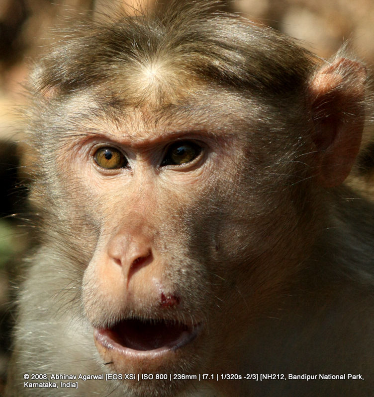
What is a forest drive without monkeys? It's not a forest drive.What is a forest drive without stopping to feed the monkeys? Not a forest drive.
One of the more enterprising things done by the Karnataka state government(s) over the years has been to put up these very distinctive signs for Karnataka Tourism that provide travelers with useful information at a glance. Like the prominent tourist attractions along the highway and the distance. The icons on the left also give you an indication of the type of tourist attraction. The temple icon next to Nanjangud for example tells you there is a historic temple there.
Search Amazon.com for karnataka tourism
Amazon.com Books on Karnataka Tourism
Search Amazon.com for karnataka tourism
View Larger Map
If you are driving from Bangalore that would indeed be the shortest path I believe. From Bangalore to Mysore via the four-laned SH17, then on to NH 212, to Gundalpet via Nanjangud. After you cross Gundalpet you need to make a right to continue on to NH 212. If you go straight, that will lead you to Bandipur (see posts), but via NH 67, and on to Tamil Nadu, the Mudumalai National Park, and the hill stations of Ooty and Coonoor.
View Larger Map
One thing you notice as soon as you get on this stretch of the highway is that the road is excellent. Parts of the highway did not have lane markings when we drove, but that could be because the asphalt looked recently laid. No speed-breakers either! Lovely. Till you hit the outer periphery of the Bandipur National Park, traffic and conditions permitting, you can do 100kmph on the highway.
As you enter the outer sections of the Bandipur National Park, the vegetation gets decidedly thicker, the habitation decidedly sparser, and the correct thing to do is to slow down and take in the serene drive at a more leisurely pace.
The thick vegetation and the tree cover makes for quite a picturesque view. If you like photography, or even if you do not, it makes for an ideal spot to pull over by the kerb and take in the scenery. I did so, and as I was shooting, I was very glad indeed to find someone as eager into highway photography that I had to snap this photo! By the way, it goes without saying that standing in the middle of a highway to photograph the highway is not a wise thing to do. No sir. Traffic was thin, so one could take the chance, unlike the Bangalore-Mysore highway that is decidedly busier, and with traffic moving much faster.
What is a forest drive without monkeys? It's not a forest drive.What is a forest drive without stopping to feed the monkeys? Not a forest drive.
One of the more enterprising things done by the Karnataka state government(s) over the years has been to put up these very distinctive signs for Karnataka Tourism that provide travelers with useful information at a glance. Like the prominent tourist attractions along the highway and the distance. The icons on the left also give you an indication of the type of tourist attraction. The temple icon next to Nanjangud for example tells you there is a historic temple there.
Search Amazon.com for karnataka tourism
Amazon.com Books on Karnataka Tourism
© 2011, Abhinav Agarwal. All rights reserved.
Sunday, February 27, 2011
Bangalore Elevated Tollway
Back in 2005 and 2006 there were complaints galore from commuters who worked in Electronics City in Bangalore, a 300 acre electronic industrial park that is one of the largest and oldest such IT parks in the country. The commuters complained that the four-laned road to the park had become so congested that a 10 km drive from The Silk Board junction to Electronics City in rush hour could take upwards of two hours. The government, in response, decided to build an elevated tollway, 10kms long that would allow commuters to get on this tollway right after the Silk Board junction which would deposit them right outside Electronics City, without any stoplights, any intersections. A four lane dedicated corridor. This tollway was completed in early 2010. For a month or so no toll was charged, which was also the best period to get on the tollway for a joy ride.
Per the Wikipedia entry on the tollway:
Per the expressay's web site , this road has been built by "a Consortium of Soma Enterprise Ltd (Soma), Nagarjuna Construction Company Limited (NCCL), and Maytas Infra Limited (Maytas)"
This photo has been taken looking north; facing the Silk Board junction. The Innova minivan and two wheelers seen in the photo are heading south, towards Electronics City.
What is interesting to note is that there is no break in the median. There is this metal barricade runs through all the way. While this has obviously been done to discourage people from getting silly and dangerous ideas about making u-turns and causing dangerous accidents. The downside is that it also becomes difficult for emergency vehicles to approach the scene of an accident or emergency from the other side of the tollway.
This is where the elevated expressway starts off on the north end, just after the Silk Board flyover:
View Larger Map
You can view some more photos at the tollway site's photo gallery.
Per the Wikipedia entry on the tollway:
The Bangalore Elevated Tollway is a 9.985 kilometers (6 mi) long elevated, tolled, access-controlled expressway in the city of Bengaluru, Karnataka, India. The project is a part of the BETL (Bangalore Elevated Tollways Ltd), project as part of the National Highways Development Project and the Elevated Highways Project. It was initiated in early 2006, and was inaugurated on 22 January 2010.[1]
Per the expressay's web site , this road has been built by "a Consortium of Soma Enterprise Ltd (Soma), Nagarjuna Construction Company Limited (NCCL), and Maytas Infra Limited (Maytas)"
This photo has been taken looking north; facing the Silk Board junction. The Innova minivan and two wheelers seen in the photo are heading south, towards Electronics City.
What is interesting to note is that there is no break in the median. There is this metal barricade runs through all the way. While this has obviously been done to discourage people from getting silly and dangerous ideas about making u-turns and causing dangerous accidents. The downside is that it also becomes difficult for emergency vehicles to approach the scene of an accident or emergency from the other side of the tollway.
This is where the elevated expressway starts off on the north end, just after the Silk Board flyover:
View Larger Map
You can view some more photos at the tollway site's photo gallery.
© 2011, Abhinav Agarwal. All rights reserved.
Sunday, February 20, 2011
Idiots on roads - 3
Straight off the bat, without even describing this photo, let me tell you there are two idiots in this photo. One you see, the other you don't. The other idiot you don't see in this photo would be me, who took this photo.
So, where is this photo from? This is from highway NH206, to Jog Falls. The Mahindra Bolero here (I think it is a Bolero) is being used as a taxi. The genius riding half in, half out, or actually mostly out, is likely an employee for the taxi operator. He has probably done this a thousand times before, this riding in this manner with the vehicle. I don't need to elaborate why I think he is an idiot.
Why am I an idiot? Well, several reasons. Because I am operating a camera while driving. While driving on a highway. Driving so close to this idiot on a car that if he were to slip, well... the end-results would be messy.
So, where is this photo from? This is from highway NH206, to Jog Falls. The Mahindra Bolero here (I think it is a Bolero) is being used as a taxi. The genius riding half in, half out, or actually mostly out, is likely an employee for the taxi operator. He has probably done this a thousand times before, this riding in this manner with the vehicle. I don't need to elaborate why I think he is an idiot.
Why am I an idiot? Well, several reasons. Because I am operating a camera while driving. While driving on a highway. Driving so close to this idiot on a car that if he were to slip, well... the end-results would be messy.
Monday, February 14, 2011
Idiots of Roads - 2
This is NH7, and that on the road is an idiot. He is an idiot because he is driving on the wrong side of the road. He is an idiot because he has a pillion rider with him who is also an idiot. The pillion rider is an idiot because he chooses to ride pillion with an idiot. The third reason he is an idiot is because he is not wearing a helmet.
© 2010, Abhinav Agarwal. All rights reserved.
Sunday, January 30, 2011
Idiots on roads - 1
See this?
This is NH7, National Highway 7 (National Highway 7 (India) - Wikipedia, the free encyclopedia), and I shot this photo near Hosur Road, as the sun was setting over the horizon.
Cutting corners to save time is so much a habit on highways that drivers don't even think twice about driving on the wrong side of the road. Not just a road, a freaking national highway!!! He is being considerate, or so he thinks, by driving partly on the shoulder, and also has his truck's headlights on. We should be thankful, right? This type of idiotic driving is the reason why one cannot drive on highways without keeping a paranoid eye peeled for trucks and buses and cars and tractors and bicycles and people and cows and goats and more that are either trying to cross the road or coming straight AT YOU.
All posts tagged with the label NH7.
Yercaud - The Drive
To Pondicherry
© 2010, Abhinav Agarwal. All rights reserved.
This is NH7, National Highway 7 (National Highway 7 (India) - Wikipedia, the free encyclopedia), and I shot this photo near Hosur Road, as the sun was setting over the horizon.
Cutting corners to save time is so much a habit on highways that drivers don't even think twice about driving on the wrong side of the road. Not just a road, a freaking national highway!!! He is being considerate, or so he thinks, by driving partly on the shoulder, and also has his truck's headlights on. We should be thankful, right? This type of idiotic driving is the reason why one cannot drive on highways without keeping a paranoid eye peeled for trucks and buses and cars and tractors and bicycles and people and cows and goats and more that are either trying to cross the road or coming straight AT YOU.
All posts tagged with the label NH7.
Yercaud - The Drive
To Pondicherry
© 2010, Abhinav Agarwal. All rights reserved.
Friday, December 24, 2010
On the road to Kodaikanal
The road to Kodaikanal, from Bangalore, is via National Highway 7 (NH7) for most of the way. You can breakup the drive into these pieces, sort of.
View Larger Map
This stretch below is after you have crossed the town of Salem, but have not quite left the hills of Yercaud completely behind. It was an overcast day, with the threat of rain on the horizon, and the clouds low enough to cover the top of the hills. The mountains in the background, and a beautifully asphalted stretch of the national highway, gentling curving its way around the mountains. I just had to stop and shoot this vista.
The Kodai Hills can be seen in the background here as you drive towards Kodaikanal, on the Kodai Ghat Road.
You know how some signals convey a ton of information? This is one such signal. The hoarding that advertises the weary and hungry traveler to the presence of a hotel not too far away - a trifling 30kms away. Let us look at the words that signal to us. First, the words "high class". Now this is almost certainly a guarantee that the hotel is likely to be infested with flies flying over food. Yes, please try for yourself, and the correlation would be hard to miss. Second, the presence of a "secured car park". Hundreds of kilometers away from a large city like Bangalore or Chennai, parking is not likely to be a problem, for the most part. If this restaurant needs to advertise that it provides secure parking tells a lot. Not all of it may turn out to be true, but nonetheless. The bottom line - if you can, avoid such restaurants. You could do a lot better by stopping a roadside dhaba and grabbing a vada pav, or plain plate of idli, or even some fruits.
I don't know which waterfall this is, but the vista was absolutely breathtaking. Partially hidden behind the mist, where you cannot make out the outlines of the mountains from which the waterfall makes it appearance, it seems to fall from the middle of the skies. Because of the continuing rains, the
As you near Kodaikanal, once you are in the Kodai hills, the road snakes left and then right and then left again. It climbs a lot, goes down a bit, and then climbs again. There are culverts at almost every turn to allow water a passage downhill.
The road is not in great shape, but it is not bad either.
The rains and the height make for lush surroundings. The green is very, very green. A very vibrant shade of green. The foliage is thick.
This is a milepost you will see if you approach Kodai from Madurai. Actually, the other way round.
This milepost below is on the way to Kodai, as you are southbound on the highway.
If it rains, it pours. If it is the mountainsides you are talking about, then it pours earth. As landslides. Incessant rains over the past several days had all been absorbed by the earth. Some of it flowed away, but there a substantial amount of water lay trapped in the soil. The soil kept on getting heavier with all this water, and as some breaking point is reached where the soil can no longer keep itself together under the weight of the heavy earth, a mudslide happens. And not in one or two places. The mudslides appear in dozens of places. That blocks the narrow mountain path leading up to the hill station of Kodaikanal. When we reached this spot below, the earth mover had already been there for some time, and the support staff had been doing a commendable job of clearing the debris away. We had to wait some 20 minutes before the road was cleared enough for the vehicles to start moving again. But the people the day before had not been so lucky. Many were stuck on the road for over 5 hours before they could proceed on with their journeys. For the month of November, such rains are fairly uncommon.
- The first is getting out of Bangalore. If you take an early start, you will beat all the morning hour rush of people heading into Bangalore and towards Electronic City. Best to do that, lest you end up spending the good part of an hour in and out of traffic jams. Since you have to be on NH7, a good starting point from where to measure distance and time is from the Central Silk Board junction. From that point, you have to go straight down the road. You can get on to the elevated expressway (Google Maps link, official web site) (Hosur Road - Wikipedia, the free encyclopedia), which saves you time but costs some Rs 40 for a one-way trip on the 10km expressway. If you run into traffic, this is probably a good option, since you will cover the 10kms in less than 15 minutes, versus the half an hour or more that you could end up driving on the same stretch of road.
- The second part is where you get out of Hosur. Bangalore may end a few kilometers from Electronic City, but Hosur is also pretty busy. Slow going there also. The road is not in very good condition, primarily because of heavy vehicular traffic that frequents this stretch. You will also come across several trucks lined up at the side of the highway. All this means that navigating this stretch is slow going.
- The third stretch is to Krishnagiri. The highway can be a bit congested because this is also the highway that people take when traveling to and from Chennai. It is only at Krishnagiri that the road to Chennai branches off as NH46. Traffic thins out after this on the highway. Some 15 kms before Krishnagiri, at Shoolagiri, you have an Adyar Anand Bhavan restaurant, and 5 kms before that a Cafe Coffee Day and a couple of restaurants.
- The fourth stretch is from Krishnagiri to Salem. Traffic is much less here, the road is excellent, and you can do good speed here. What is good speed? Well, weather and traffic conditions permitting, 100kmph is very doable. Some even speed at 120kmph+, but that is not recommended. It's way too fast for you to have time to respond to a sudden eventuality, like a goat deciding to cross the road at the last moment, or a bicyclist deciding to run the gauntlet to the other side of the highway despite the frantic protestations of your honking.
- The last stretch on this highway is from Salem to Dindigul. While there is a bypass to skirt you around Salem, you still end up entering the town, and may get caught up in the traffic here. After Salem, the highway is much, much less busy, and you can do very good speed here. If the weather is good, you can do 100 kmph for extended periods of time. There is nothing here by way of a Cafe Coffee Day or a nice restaurant. There may be something inside the towns you pass along the way, like Namakkal or Karur, but that would mean getting off the highway, and this adds to your travel time.
- You have to get off the highway just before Dindigul and take old NH45 and then the Kodai Ghat Road. From Dindigul to Kodaikanal is approximately 90 kms, and expect to take 2-3 hours to cover this stretch.
View Larger Map
This stretch below is after you have crossed the town of Salem, but have not quite left the hills of Yercaud completely behind. It was an overcast day, with the threat of rain on the horizon, and the clouds low enough to cover the top of the hills. The mountains in the background, and a beautifully asphalted stretch of the national highway, gentling curving its way around the mountains. I just had to stop and shoot this vista.
The Kodai Hills can be seen in the background here as you drive towards Kodaikanal, on the Kodai Ghat Road.
You know how some signals convey a ton of information? This is one such signal. The hoarding that advertises the weary and hungry traveler to the presence of a hotel not too far away - a trifling 30kms away. Let us look at the words that signal to us. First, the words "high class". Now this is almost certainly a guarantee that the hotel is likely to be infested with flies flying over food. Yes, please try for yourself, and the correlation would be hard to miss. Second, the presence of a "secured car park". Hundreds of kilometers away from a large city like Bangalore or Chennai, parking is not likely to be a problem, for the most part. If this restaurant needs to advertise that it provides secure parking tells a lot. Not all of it may turn out to be true, but nonetheless. The bottom line - if you can, avoid such restaurants. You could do a lot better by stopping a roadside dhaba and grabbing a vada pav, or plain plate of idli, or even some fruits.
I don't know which waterfall this is, but the vista was absolutely breathtaking. Partially hidden behind the mist, where you cannot make out the outlines of the mountains from which the waterfall makes it appearance, it seems to fall from the middle of the skies. Because of the continuing rains, the
As you near Kodaikanal, once you are in the Kodai hills, the road snakes left and then right and then left again. It climbs a lot, goes down a bit, and then climbs again. There are culverts at almost every turn to allow water a passage downhill.
The road is not in great shape, but it is not bad either.
The rains and the height make for lush surroundings. The green is very, very green. A very vibrant shade of green. The foliage is thick.
This is a milepost you will see if you approach Kodai from Madurai. Actually, the other way round.
This milepost below is on the way to Kodai, as you are southbound on the highway.
If it rains, it pours. If it is the mountainsides you are talking about, then it pours earth. As landslides. Incessant rains over the past several days had all been absorbed by the earth. Some of it flowed away, but there a substantial amount of water lay trapped in the soil. The soil kept on getting heavier with all this water, and as some breaking point is reached where the soil can no longer keep itself together under the weight of the heavy earth, a mudslide happens. And not in one or two places. The mudslides appear in dozens of places. That blocks the narrow mountain path leading up to the hill station of Kodaikanal. When we reached this spot below, the earth mover had already been there for some time, and the support staff had been doing a commendable job of clearing the debris away. We had to wait some 20 minutes before the road was cleared enough for the vehicles to start moving again. But the people the day before had not been so lucky. Many were stuck on the road for over 5 hours before they could proceed on with their journeys. For the month of November, such rains are fairly uncommon.
© 2010, Abhinav Agarwal. All rights reserved.
Subscribe to:
Posts (Atom)